Innovation to Impact. See you at the July ESIP Meeting.
How To Not Get Burned: Collaborate on Wildfire Data
This is the scenario from a tabletop exercise hosted by the Earth Science Information Partners (ESIP) and the Centre for Law and Spatial Policy together with support from the U.S. Group on Earth Observations (USGEO). More than 25 commercial data providers and legal experts joined the wildfire data exercise along with federal partners, acquisition specialists and the academic community, which included 50 observers.
ESIP, USGEO, and Center for Law and Spatial Policy share “Big Data Use in Wildfire Management: How Not to Get Burned by the Legal Challenges of Data Sharing” that summarizes the October 2021 event, and coincides with a public-private partnerships plenary during the ESIP January Meeting running January 18-21.
“Several of the panelists from our ESIP plenary were contributors at the tabletop exercise,” said Susan Shingledecker, Executive Director at ESIP. “We see this as a chance to continue the conversation. As a collaborative organization that supports Earth science data professionals, we at ESIP see the potential of public-private partnerships as essential both exciting and challenging.”
Read the Report
Available on the USGEO website, the report “Big Data Use in Wildfire Management: How Not to Get Burned by the Legal Challenges of Data Sharing” shares information and insights about effective public-private partnerships using Earth science data on wildfire as a case study.
Public-private partnerships require integration and trust
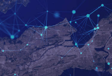
The exercise focused on exploring how USGEO and federal agencies can leverage the private sector and commercial industry to identify causes and consequences of wildfires as well as determining the risks to surrounding communities, ecosystems and infrastructure.
The findings demonstrate the challenges and opportunities to advance more effective integration and use of commercial capabilities in critical application areas. Two key findings: the U.S. Government plays a critical role in the Earth observation enterprise both as a consumer of private data and a regulator of this industry; also, license agreements are central to the success of government and commercial collaborations.
“The role of agencies is laid out in their missions, and while they differ, they all have a responsibility to ensure good data and quality analysis. They also understand the value of collaborating with industry to complete their missions,” said Ezinne Uzo-Okoro, Assistant Director for Space Policy, Office of Science Technology Policy at the White House. “The challenge is finding a workable balance between responsive and fair exchanges of data and resources.”
True-color image of the Monument and McFarland fires burning in California, taken on August 19, 2021 by the Operational Land Imager (OLI) on Landsat 8. Image credit: NASA Earth Observatory
ESIP pulls together organizations across industry, government and academia
Building on the report, as part of the January 2022 ESIP Meeting, a panel of participants from the fall workshop shared the issues and discussion with a broader audience in ESIP’s interactive plenary format. A recording of this session will be available on ESIP’s YouTube channel in early February.
Uzo-Okoro joined Allison Wolff, CEO of Vibrant Planet, and Kevin O'Brien, CEO of Orbital Insight as a part of the ESIP plenary. Their main point: Collaboration between industry, government agencies and academic research is essential to fully leverage geospatial data for greater good.
“We need to broaden our perspective on how we relate to land, and I do think that data and technology can help us do that — we can actually see and manage risks and opportunities down to the tree/house level,” Wolff said during the plenary, adding that she sees the need for a combination of creating intuitive data exchange platforms like her company’s Land Tender app as well as a mindset change. “ In our capitalist system, what we need to do in very short order, is to make forests more valuable living than dead. That’s the blunt truth of the matter.”
She points out that many groups of people do relate to the Earth in a more life-affirming way and, highlighting the key points from the key points from the ESIP Opening Plenary: Moving beyond Principles to Practice – Engaging Indigenous Communities, Wolff says bringing diverse voices to decision making as well as data gathering and use is essential. Wolff’s co-presenter O’Brien also spoke to the importance of making data accessible to broader communities and pointed out the power of specificity. When working with clients, O’Brien’s company tries to go from answering a thousand questions to digging deeply into a handful.
“What we have found is this intersection of questions that people have, open up opportunities to share and collaborate on more results across the world,” O’Brien said, adding that the beauty of geospatial insights is that they cover every inch of the world and it enables looking at environmental problems at scale. “We’re not a silver bullet solution but we’re part of the solution.”
How to Not Get Burned: Next Steps in Wildfire Data
As Wolff pointed out in her plenary remarks, she looks for “tree-level” data. That is, efforts that enable the specificity O’Brien seeks and the far-reaching collaborations Uzo-Okoro calls for — data, partnerships and exchanges that see the forest and the trees.
In that regard, ESIP community members are planting saplings and stewarding forests. Several ESIP collaboration areas have clustered around wildfire as an urgent issue, pulling in expertise in envirosensing, disaster life cycles, climate and agriculture, semantics, community resilience and land management. Two community-led breakout sessions at the January 2022 ESIP meeting focused on wildfire: In-situ and remotely-sensed data integration for wildfire management and ESIP Cross-Domain Collaboration Laboratory — Let’s Look at Wildfires.
USGS sponsors ESIP activities and Tim Newman, Program Coordinator for the USGS National Land Imaging Program, agrees that collaboration is essential.
“The expert perspectives of Earth observation data providers, intermediaries and users are precisely what U.S. agencies need to optimize public-private partnerships for wildland fire response and ecosystem sustainability,” Newman said. “We appreciate their input and hope to continue this dialogue to maximize the societal benefits of ours and others’ remote sensing systems.”