Innovation to Impact. See you at the July ESIP Meeting.
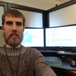
Making Data Matter with Daniel Wieferich

ESIP is 20 years old! To celebrate, we interviewed ESIP community members about their perspectives on the progress of making Earth science data matter from over the last 20+ years. This is the ninth interview to be released. Check out other interviews in the series here.
Interviewee: Daniel Wieferich, United States Geological Survey (USGS)
Interviewer: Arika Virapongse
Date of interview: July 18, 2018
Arika: Could you tell me about when and how you got started working in the field of data and informatics, particularly in regards to Earth Science?
Daniel: I did a degree in Fish and Wildlife Management. When I was doing my master’s degree (during 2008 or 2009), I started dabbling in what I thought was big data at the time–several thousands of records. It was when I started understanding that there are a lot of data out there.
For my first project outside of school, I worked on a national assessment of risk to fish habitat due to climate and land use change, and it really caught me off guard. That project introduced me to the real concept of big data. The need for people to go beyond Excel/Access and traditional science data management to more of a true data management.
Over the last 5-6 years, I’ve been more exposed to the data and informatics communities. I’m now starting to pick up on some of the terminology in the field.
What was the learning curve like? How did you gain the skills and training that you needed?
I am self-taught for the most part. After my graduate studies and about 2-3 years after starting with Michigan State University on a National Scope Data Products project, I did go back to get a certificate in computer programming at a community college. So I got retrofitted to the terminology and such. I still struggle with the terms, however, because I’m self-taught. I can understand it, but I don’t speak it as well as others.
I’d like to understand how the political, science, and technology context supports the importance of Earth Science data in society. Do you have any insights or thoughts about how this context has helped or hindered your ability to work in this field?
My data journey has been shaped by my changing perspectives on what data are available, what you can do with data, and how you should go about managing information. In the short period of time after I left my graduate studies at the university, they started introducing data-oriented and coding courses within the Fish and Wildlife Management degree program. At that time, I was in the position of looking back from just a few years ahead, and thinking that I wished that they had had those courses when I was a student, although they probably had some in the computer science department that I missed out on. I have seen some of this shift across the sciences, where folks are starting to pick up on that need–trying to teach these skills to up and coming scientists.
What are some of the major challenges and issues facing Earth Science data / informatics today?
In the short time that I have been involved in the field, I have been exposed to the rapid amount of information that is coming in. Even within agencies there is so much information. In situations where there are collaborative opportunities, it is still very difficult to standardize information. There are also a lot of different groups that are doing similar standardization efforts, but each are slightly different. Being on the science end of things, it is hard for me to keep up with all of the different opportunities and be exposed to these communities enough to know who to reach out to.
To a certain extent, to keep things moving, you need to balance the amount of efforts that you really dig into and fully understand. Over the last few years, it has been helpful for me to have built up a community of people who know the different pieces well. Communities that address specific scientific data issues, like ESIP (Earth Science Information Partners) or DataOne. In addition, I have management at USGS (United States Geological Survey) that supports my needs and has been exposed to these communities already. The domain science communities that I interact with most are freshwater aquatics and landscape ecology, which is a small enough group for me to get to know well.
Are there other data groups that you interact with?
The group that I work with at USGS is associated with a lot of different data groups, but personally this was my first ESIP meeting (2018 ESIP summer meeting). I went to the RDA (Research Data Alliance) meeting in Denver in 2017, and that was my first data meeting. So, I’m just starting to be fully exposed to these groups, and am still trying to pick up on what efforts within these groups to focus on. As I mentioned, my supervisor and colleagues are exposing me to a lot of the concepts, and encourage me to look into them more. But I come to a meeting like this one (2018 ESIP summer meeting), and there are so many sessions that I want to attend. I am trying to wade through what to invest my time into.
Where do you think or envision that data and informatics in your field is going in the future?
I have worked a lot with national scale data sets, and there are more of these data sets coming on board that are inconsistent. LiDar (Light Detection and Ranging) is also getting to be pretty important. There are a lot of regional datasets available and initiatives to try to bring these datasets into the larger national effort, but there are many different landscape-level influences that need to be addressed or recognized as big players, for example, biogeography and biodiversity issues. On the data end of things, there is a lot more information becoming available and opening more opportunities for different science to be happening. Hopefully there will be a shift within the science community to be able to work with that sort of information, as well as new tools to help with that transition.
[Disclaimer: The opinions expressed in this interview are those of the author alone and do not necessarily reflect official USGS, US government policy, or any other organizations listed here. This interview also represents an “oral history” (a recollection of history), so its value is in the personal perspectives and insights of the interviewee, rather than specific dates, years, and titles for reference.]


