This week we will pass the 90 day mark leading up to the ESIP Summer Meeting in Tacoma – a key milestone for those of you who may need to forecast your attendance. With a fantastic plenary lineup and a growing list of proposed breakout sessions, there are numerous reasons to register now for the meeting and submit your own session proposal by the deadline of 4/26.
This summer's meeting will include a new feature – the Research Showcase, an evening event that will combine the ESIP Poster & Demo Session (traditionally held at ESIP Winter Meetings) with Research as Art (usually held at ESIP Summer Meetings). When you register for the meeting, you can indicate that you would like to contribute in any or all of the following ways: present a poster, demo something, and share artwork. We hope that you will be excited by the variety of ways you can communicate your research during this memorable evening.
This week, we also want to remind you of the GeoSemantics Symposium and the Teacher Workshop taking place in conjunction with the ESIP Meeting. Read on to learn more.
Finally, be sure to join us on Friday 4/19 at 1 pm ET for the next ‘Data in Action' Webinar: ESIP Collaboration Area Highlights. Find out what 12 of ESIP's Clusters and Committees are doing to increase the use and value of Earth science data and information.
Have a great week everyone,
Megan
—
Megan Carter Orlando
ESIP Community Director
Earth Science Information Partners
The GeoSemantics Symposium, hosted by ESIP's Semantic Technologies Committee, will take place on Monday, July 15th, the day before theESIP Summer Meeting kicks off. This year's theme is Building Harmony between Data Semantics and Machine Learning. Register now to join us for the full week of action!
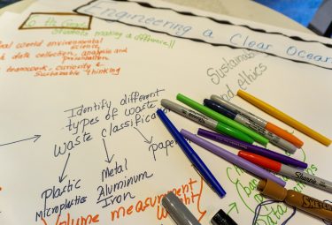
The ESIP Education Committee is looking for science and technology teachers from middle, high school, and community colleges to join the Data in Action Teacher Workshop to be held on Wednesday, July 17th at the ESIP Summer Meeting. Participants will learn how to put data in action in the classroom through the use of Jupyter Notebooks and other Earth science tools. Learn more and reserve your spot here.
Join the next webinar in ESIP's ‘Data in Action: Increasing the Use and Value of Earth Science Data and Information‘ Webinar Series
Thursday: Research Object Citation; Education; Drones
Friday: Machine Learning; Data in Action: Collaboration Area Highlights Webinar
See the full telecon calendar here. Select the meeting you'd like to attend, login instructions are included in description.
More ESIP News
Next ‘Data in Action' Webinar: ESIP Collaboration Area Highlights (4/19 at 1 pm ET)
ESIP is home to 30+ community-driven collaboration areas (clusters, committees, & working groups) aimed at addressing diverse Earth science data challenges and opportunities. In the second webinar in the series ‘Data in Action: Increasing the Use and Value of Earth Science Data and Information,' ESIP collaboration area representatives will share lightning presentations about their goals and activities in line with the webinar series theme. Webinar attendees can expect to gain a broader awareness of ongoing ESIP collaboration area efforts and to find out how to get involved. Participating collaboration areas include: Agriculture & Climate, Community Resilience, Data Stewardship, Disaster Lifecycle, CLEAN Network, Education, Envirosensing, Information Quality, Marine Data, Research Object Citation, Semantic Technologies, and Usability.
Spring 2019 Out2Lunch Webinar Series
The Spring 2019 Out2Lunch Webinar Series has concluded, but you can catch the whole series of 10 minute demos of Earth science tools and resources here. Thanks to the Education Committee for organizing another awesome series of webinars!
News from Around the Community
Open Geospatial Consortium (OGC) Invites Developers to the OGC API Hackathon
According to OGC, the most important hackathon in OGC history will take place in London on June 20th and 21st, 2019. The event will test draft OpenAPI-based specifications for features, coverages, map tiles, and processes using a common Application Programming Interface (API) template. It will be instrumental to the evolution of OGC web standards to a modern API-based approach, setting the course for open geospatial standards – in and outside OGC – for the next decade. For more information, including venue information, registration requirements, and expected skill sets, visit the OGC API Hackathon event page or register on Eventbrite by 5/3.
Earth and Environment Science Information Partners (E2SIP) – 3rd Workshop
The next in a series of workshops supporting information interoperability in the Earth and environment science community will be held at CSIRO Black Mountain (Canberra, Australia) on Thursday May 9th in association with the C3DIS 2019 conference. The Australian E2SIP collaborates with the US-based ESIP Federation to share technologies, practices, and conventions, and build the community of practitioners primarily from the research and government sectors. The workshop is structured around a series of breakouts on topics including drones, data management, and big data, and plenary sessions to set the scene and plan next steps. The detailed program can be previewed here. If you are interested in attending, please complete the form at this Eventbrite ticket link.
2019 EarthCube Annual Meeting — Call for Abstracts — Extended to 4/19
The EarthCube community extends a special invitation to the geoscience community to participate in the 2019 EarthCube Annual Meeting in Denver, CO, June 12-14, 2019. The deadline to submit abstracts has been extended to 4/19. EarthCube welcomes presentations about research enabled by the use of advanced cyberinfrastructure and about new computational capabilities that enable and support geoscience. Submit Abstracts Here.
Gateways 2019 Call for Participation
The 4th Gateways Annual Conference, which will be hosted Sept 23-25, 2019 in San Diego, CA, is an opportunity for gateway creators and enthusiasts to learn, share, connect, and shape the future of gateways. Gateways are user-friendly interfaces to scientific computing, data, and other domain-specific resources to support research and education. This year's conference is co-located with the eScience conference. It will feature hands-on tutorials, demos, keynotes, presentations, panels, posters, and more. Submissions of papers, demos, tutorials, and panels are now being accepted. To learn more and submit, see here.
NASA Frontier Development Lab 2019 Challenge Areas
The NASA Frontier Development Lab (FDL), hosted by the SETI Institute, is an interdisciplinary research accelerator that combines talented researchers in AI with domain specialist researchers at the PhD and Postdoc level. FDL is looking for talented researchers with interest and capacity in several challenge areas for a 2019 research sprint. Places are open for both Researchers and Mentors, who receive a stipend and accommodation at NASA Ames in Silicon Valley for eight weeks, 6/24/2019-8/16/2019. See the challenge areas and apply here.
Register for the FORCE11 Scholarly Communication Institute (FSCI)
FSCI is a week-long program of coursework, group activities, and hands-on training around the latest trends in scholarly communication to be held Aug. 5th-9th, 2019 in Los Angeles, CA. Courses feature the latest technologies in research flow, new forms of publication, current standards and expectations, and explores ways of measuring and demonstrating success that are transforming science and scholarship. Who should attend? Researchers, librarians, publishers, university and research administration, funders, students, and post docs from across the sciences, social sciences, and the humanities. Learn more, register, and apply for travel assistance here.
Submit to ApacheCon NA 2019 – Geospatial Track
ApacheConNA will be September 9-13, 2019 in Las Vegas, Nevada, USA. Submit presentations now here to the Geospatial Track, which will consider a range of geospatial implementations ranging from location as an attribute, to projects which perform spatial analytics including handling of coordinate reference systems (CRSs), geometries and arrays. Emphasis is invited on the use of open standards including the recently updated CRS Well Known Text, version 2 from the Open Geospatial Consortium (OGC). The geospatial track will foster discussions leading to reduced development effort through reuse and increased quality of geospatial information handling. Discussions about this track are invited on geospatial@apache.org.
CIMSS Announces GOES-16/17 Virtual Science Fair
As part of the GOES-R Education Proving Ground, the Cooperative Institute for Meteorological Satellite Studies (CIMSS) is holding a Virtual Science Fair to encourage students (grades 6-14) to work with GOES-16 or GOES-17 data to investigate weather and natural hazards. Prizes include official GOES-T launch invites and coaches of the winning teams will have their travel paid to AMS Centennial meeting. Learn more and apply here by 5/3.
Questions/comments? Reply directly to this note or click the button below to email us at staff@esipfed.org
ESIP is funded with support from NASA, NOAA, and the USGS.