Innovation to Impact. See you at the July ESIP Meeting.
Water and Fire: ESIP Lab Awards Support Innovation and Learning
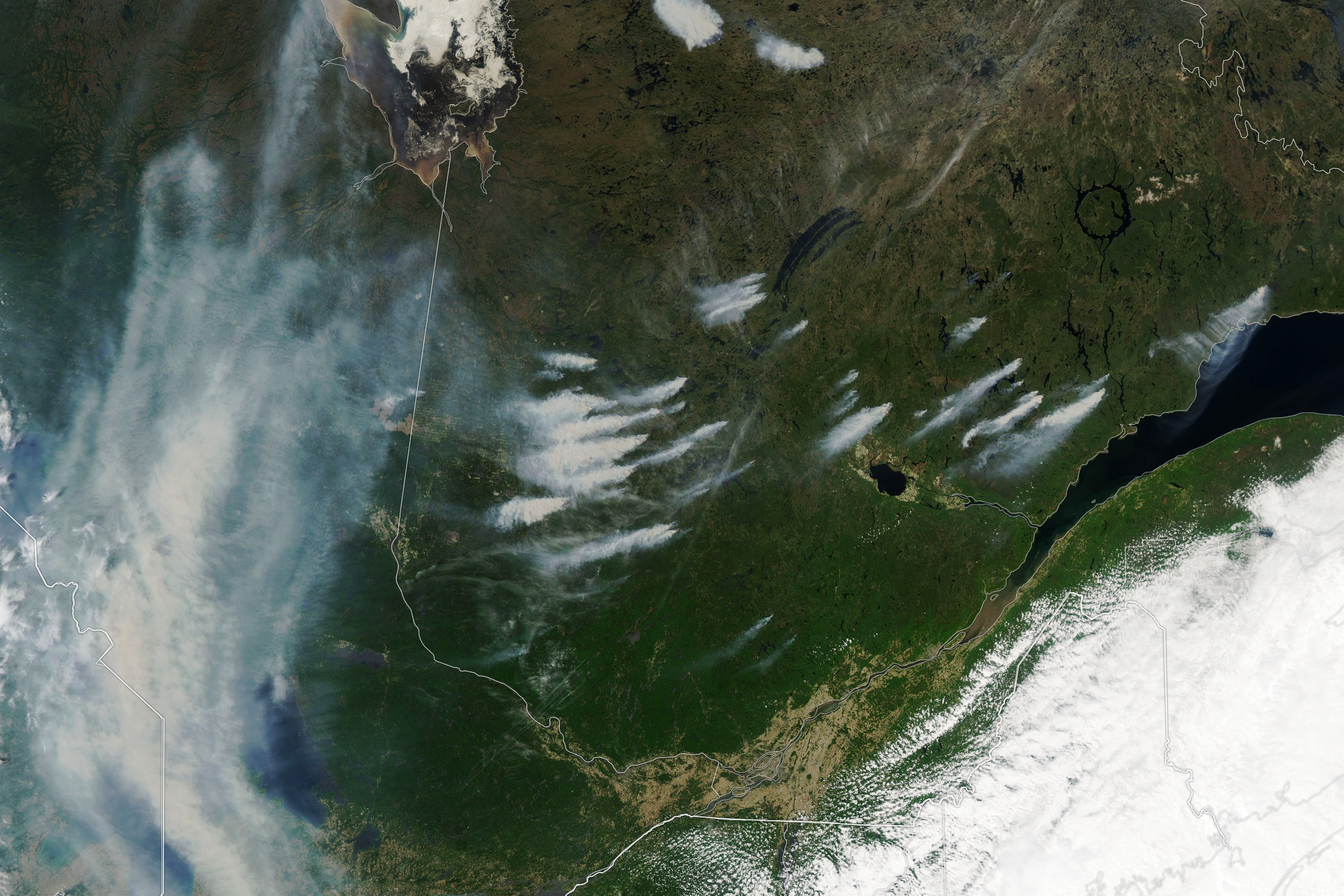
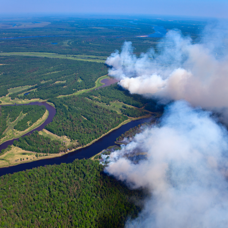
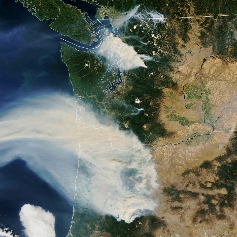
Wildfires and water resources are two crucial parts of Earth science data research. The Moderate Resolution Imaging Spectroradiometer (MODIS) on NASA’s Aqua satellite captured this view of smoke billowing from Canadian fires on June 3, 2023.
Innovation and applied knowledge is core to the Earth Science Information Partners (ESIP) community. Each year, the ESIP Lab funds pilot projects to expand the impact of Earth science data. For the 2023 cohort, researchers focus on technology and computing to better understand and respond to challenges related to water resources and wildfire.
ESIP is part of a thriving community of Earth science data and software specialists. From 30+ Collaboration Areas to the upcoming ESIP July Meeting, ESIP bridges different disciplines and sectors.
But the ESIP Lab plays a unique part in the community, especially through funding pilot projects.
“Seed funding plays an important role in the science and technology landscape,” said Annie Burgess, ESIP Lab Director. “It acts as a catalyst for investigators to take intentional steps to advance novel scientific and technical projects. In addition, our seed funding program has an education component where investigators are charged with developing new technical skills while they prototype, ultimately leading to increased productivity for both the individual and the larger science community.”
The newly funded cohort of investigators all focus on technology needs for better understanding water resources and wildfire.
ESIP is proud to support six pilot projects through the ESIP Lab this year.
- Project One – Lynker: Increasing environmental data access through a more robust federated data catalog and extending the climateR model to Python
- Project Two – CarbonPlan: Real-time visualization of satellite-derived active fire data to support monitoring of forest offset projects
- Project Three – Alabama Water Institute: Open Science: Community Streamflow Evaluation System (CSES)
- Project Four – Ocean Analytics Institute: Insect Pollinator Network Composition in Post-Fire Recovery of Coastal Sage Scrub
- Project Five – UC Davis: Prototyping an Image-based Coastal Fog Detection Network
- Project Six – EPIC: Water Service Area Boundaries
The ESIP Lab is a space for innovation in Earth science data, technology and computing.
The ESIP Lab provides small grant funding to enhance efforts around topics broadly identified as ‘priority areas’ by the Earth science community. All ESIP Lab funding opportunities require investigators to include both technical and learning objectives in their proposals. By promoting learning within project solicitations, the ESIP Lab seeks to increase the collective technical savvy of the Earth science community and promote transparency about the skills required to understand our changing planet.
Learn more: esipfed.org/lab
Bring climateR model to Python
Increasing Environmental Data Access through a more robust federated data catalog and extending the climateR model to Python
Rachel Bash and Mike Johnson from Lynker
Agencies like NASA, USGS, NOAA and ESA collect, process and publicize Earth system data to help answer some of today's most pressing issues related to water, wildfire, and the environment.
Yet, there are no standard methods to find and access data.
We are building an open-source project that federates thousands of data sources in a common catalog along with tools to generate manageable subsets for analysis and visualization. We hope to improve the maintenance of the catalog using cloud solutions, extend these tools to the Python community, and leverage relationships with USGS, NOAA and Colorado partners to expand its uptake.
The team’s learning objectives include identifying best practices for using Github Actions and Workflows, learning how to execute Bash based Github Workflows launching R and Python scripts and identify strategies for safety uploading files to a public s3 from Github Workflows.
Open up fire data for forest monitoring
Real-time visualization of satellite-derived active fire data to support monitoring of forest offset projects
Max Jones, Oriana Chegwidden, Grayson Badgley and Kata Martin from CarbonPlan
There is a rich archive of near real-time satellite-derived active fire data that informs wildfire management. However, accessing this data can be challenging, limiting use in research and planning.
This project will lower the barriers to using these data by developing open, reproducible data management workflows and tutorials. We will demonstrate how to use these new fire data by incorporating them into our existing fire and offset project monitoring tool. Augmenting this tool will support ongoing public monitoring and reporting about forest offset projects burning throughout the 2023 U.S. fire season.
The team’s learning objective for this project includes determining the optimal chunking scheme for the sparse point data to leverage empty chunks, informed by ongoing community discussions.
Flow into hydrological data streams
Open Science: Community Streamflow Evaluation System (CSES)
Md. Shahabul Alam and Ryan Johnson from the Alabama Water Institute and Dane Lijestrand from the University of Utah
This project seeks to operationalize the Community Streamflow Evaluation System (CSES). The team’s goal is to align the platform with the USGS Water Resources Mission Area and make it a publicly accessible and model-agnostic evaluation system for hydrological modeling.
The team will do this by including rapid data access, modules for evaluating streamflow predictions across multiple domains and timescales, plus deployment via an interactive website and visualization platform supporting the evaluation of user models.
The project will facilitate connections across the Earth and computational sciences to reduce the barriers to scientific inquiry, supporting the transition of open science to operations in hydrology.
The team’s learning objective focuses on how to adapt the CSES into the Basic Model Interface (BMI) protocol for seamless use across developers and platforms. Adaptation to BMI will allow CSES to reach more users and encourage the evaluation of user models.
Conserve pollinator habit after fires
Insect Pollinator Network Composition in Post-Fire Recovery of Coastal Sage Scrub
Christina Simokat and Liz Ferguson from Ocean Science Analytics and California State University San Marcos
Pollination is responsible for a significant portion of the world’s crop yields, which are impacted by recent declines in pollinators due to climate change and loss of natural habitat.
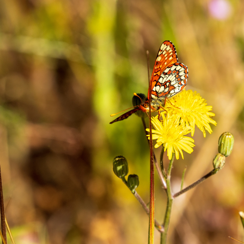
This project evaluates the impact of wildfires on viable pollination habitat through a combination of in-situ monitoring and an ecosystem services software, InVEST. Using deep-learning insect detection methods and crop pollinator models, this project aims to provide resource managers with information to inform conservation and restoration practices.
The project team will learn how to use the InVEST ecosystem services tool. The goal is to obtain geospatial information and compare natural capital in post-fire and unaffected areas.
Improve local detection of coastal fog
Prototyping an Image-based Coastal Fog Detection Network
Sonya Rauschenbach from University of California Davis, John Kim from Pacific Northwest Research Station, U. S. Forest Service and Alex Dye from Oregon State University
Coastal fog is crucial to the ecology of coastal areas around the world. Due to the complex and dynamic nature of coastal fog formation, the quantification of fog’s role in local water cycles requires a high-resolution dataset.
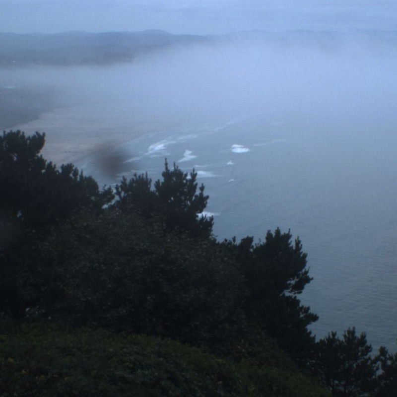
The project team has a collection of images from seven locations along the Oregon coast. With these images, the team will prototype a method for automatically detecting coastal fog in images using existing public webcams. If successful, the methodology can be applied to webcams globally.
The team will learn how to develop deep learning models with Python’s pytorch package and how to parallelize these models with Horovod. Additionally, they will learn how to create interactive charts with Shiny, an interactive web application.
Map where people get their water
Water Service Area Boundaries
Jessie Mahr and Gabe Watson from Environmental Policy Innovation Center
There are nearly 50,000 community water systems in the U.S. that serve 90 percent of the population. And despite the importance of water to health, safety, economic mobility and overall well being, there is not a comprehensive, accurate map of who those systems serve.
The Environmental Policy Innovation Center is working with local, state, tribal and federal partners to create an accurate and accessible map of drinking water service area boundaries to support the design and implementation of environmental justice, water and wildfire programs at the federal, state and community levels.
The team’s learning objective focuses on determining the methods by which communities can work with government partners to improve the accuracy of modeled or collected data.
Allison Mills and Annie Burgess wrote this news release based on plain language summaries provided by the awarded teams. All of the award PIs reviewed their sections. The news release was provided ahead of posting to all the awardee’s organizations as well.
ESIP stands for Earth Science Information Partners and is a community of partner organizations and volunteers. We work together to meet environmental data challenges and look for opportunities to expand, improve, and innovate across Earth science disciplines.
Learn more esipfed.org/get-involved and sign up for the weekly ESIP Update for #EarthScienceData events, funding, webinars and ESIP announcements.