ESIP Lab November UpdateFall 2018 ESIP Lab RFP, Winter Meeting Call for Sessions, SensorDat Update, ESIP Lab @SGCI

ESIP Lab Update: November 2018 

Highlights from your favorite virtual Earth science tech lab.

View this email in your Browser | esipfed.org/esip-lab


Greetings all –

As travel winds up and 2018 winds down we hope you are all getting excited about the 2019 ESIP Winter Meeting. I encourage you to submit to our call for sessions (DEADLINE: Friday, November 16th)! This is YOUR chance to drive the meeting agenda and be part of the preeminent meeting for Earth data technologists. Also if you haven't registered, you can do so here.

We hope to see you there!

Annie Burgess
Director, ESIP Lab

REMINDER: ESIP Education Committee is hosting its monthly Out-to-Lunch webinar today titled GPS-STEM curriculum – Engage your students in real-world applications of STEM concepts inspired by GPS. Login details can be found on the ESIP telecon calender here.

Fall 2018 ESIP Lab Incubator Request for ProposalsBuilding a SpatioTemporal Feature Registry

Through this Request for Proposals (RFP), the ESIP Lab will provide seed funding for incubator-style projects. Incubator projects run 6-8 months and lie in the realm of good ideas ready to be tried out. Project budgets should not exceed $10,000.

We have identified the following topics as areas of need in the Earth science community, and for this RFP, project proposals that address these areas will be given priority.

  • Proof-of-concept for emerging technologies slated for operational use.
  • Modernization of Earth science workflows using open source, machine learning and cloud computing.
  • Extension of open source software critical to collecting, distributing, or analyzing Earth observations.

Although this RFP will give priority to proposals addressing the bulleted topics above, other high-quality proposals will also be given consideration, including:

  • Projects expanding Science Gateways Community Institute outcomes.
  • Projects relevant to the Midwest Big Data and Innovation Hub.

Please find the full RFP here

Funded Project Highlight
SensorDat: Real-time sensor testbed for improved provenance and data quality

Real-time sensors are increasingly being used for scientific analysis and discovery in earth science research. The Internet of Things (IoT) concept describes an environment in which small, inexpensive sensors become ubiquitous and stream their data to the Internet in real-time. However, sensors used for scientific research purposes require additional sophistication due to issues surrounding standards and metadata requirements, spatial and temporal coverage, data quality considerations, measurement specifications, and geolocation information. To address the IoT, an NSF-funded project called “Cloud-Hosted Real-time Data Services for the Geosciences” (CHORDS, see chordsrt.com) was proposed and funded in 2016 to explore the use of real-time data in a scientific context.

The SensorDat ESIP Lab project is working on 1) extending the use of CHORDS to real-time data streams that are outside of the traditional NSF Geosciences domain, including new varieties of sensors that take advantage of IoT miniaturization, and 2) developing advanced workflows focused on automated data quality and data quality annotation and/or correction.

Progress thus far: 
1) https://github.com/ESIPFed/SensorDat
2) Recipes for common data quality issues: https://github.com/ESIPFed/SensorDat/tree/master/example
3) Real-time data from the Nevada Climate Change system was interfaced with a SensorDat CHORDS instance at nevcan.chordsrt.com
4) Real-time data from the McMurdo and Sevilleta LTER sites was tested with a SensorDat CHORDS instance at lter1.chordsrt.com

ESIP Lab Funded Projects at SGCI Bootcamp 

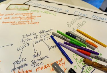
Eleven earth-science focused projects recently participated in an ESIP-supported Science Gateways Community Institute Bootcamp held at NCAR in Boulder, CO. Of that group, three were ESIP Lab-funded projects included GeoWeaver (PI: Ziheng Sun), ESIPhub (PI: Keith Maull), and Water Mesh (PI: Christina Bandaragoda).

Throughout the week, teams engaged in hands-on activities to help articulate the value of their work to key stakeholders and to create a strong development, operations, and sustainability plan, including:

  • Core business strategy skills
  • Message refinement skills
  • Long-term sustainability strategies

By the end of the Bootcamp, teams had developed a value proposition, a working hypothesis of their sustainability strategy and identified the key action steps to get there!

It was a fantastic experience for all. Learn more about how your project could participate in the next SGCI Bootcamp here

Funding Highlight: Microsoft AI for Earth Grants

Next Generation Animal Tracking Ideation Challenge

AI for Earth awards grants to support projects that change the way people and organizations monitor, model, and ultimately manage Earth’s natural systems. Depending on project need, our grants can award Microsoft Azure cloud computing resources (including AI tools) and/or data labeling services.

GitHub

Twitter

Website

https://www.esipfed.org/esip-lab

Questions/comments? Reply directly to this note or email us at lab@esipfed.org

Keep up on all the action on Slack! If you are not already on the ESIP Slack team: here is your INVITATION.  If you are on Slack, are you using the Slack App? It's a much better GUI. Grab it HERE

ESIP is funded with support from NASA, NOAA, and the USGS. 

Copyright © 2018 Earth Science Information Partners, All rights reserved.
 You are receiving this note because you subscribed to one one of the ESIP list-servs.
unsubscribe from this list    update subscription preferences