ESIP is a home for Earth science data professionals. As a nonprofit funded by cooperative agreements with NASA, NOAA, and USGS, we bring together interdisciplinary collaborations to share technical knowledge and engage with data users.
ESIP Vision
A world where data-driven solutions are a reality for all by making Earth science data actionable by all who need them anytime, anywhere.
ESIP Mission
Empower innovative use and stewardship of Earth science data to solve our planet’s greatest challenges.
Core Values
Integrity
Inclusiveness
Collaboration
Openness
Curiosity
ESIP at a Glance
- Who We Are
- History
- Collaboration
- Impact
Data People Working Together
If you were to ask, “Who is ESIP?”—there are really two good answers:
- The ESIP community includes 170+ Partner organizations and individual volunteers who come together to share, expand, and innovate across environmental science disciplines.
- ESIP itself is a nonprofit organization run by a small, dedicated team who manage the behind-the-scenes work that goes into facilitating collaboration.
Of course, the best way to understand who we are is to see for yourself. Ready to join us?

Over 25 Years of Collaboration
Created by NASA in 1998, ESIP was formed in response to a National Research Council recommendation calling for the involvement of community stakeholders in the development of NASA’s Earth Observing System Data and Information System (EOSDIS) as a critical element of the U.S. Global Change Research Program.
Since its inception, ESIP has continually grown and attracted a diverse group of partners, which now includes 170+ partner organizations.

It's What We Do!
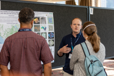
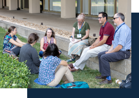
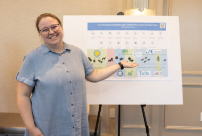
The ESIP community comes together to tackle domain-specific issues as well as cross-domain challenges related to Earth science data and computing.
Our Collaboration Areas welcome newcomers, so find a topic you’re passionate about and take a seat at the table. (And if you don’t see an area that fits your expertise, start your own!)

Amplifying the Impact of Our Partners
ESIP brings together more than 170 organizational partners and individual volunteers to share insights and experiences surrounding Earth science data.
By providing the time and space for collaboration to happen, we expand the impact that our partners are already making. We do together what we could never do alone.
ESIP IS SUPPORTED BY:


What Makes ESIP Unique?
Established Network
Along with hundreds of individual participants, we have over 170 organizational partners working together to further environmental data science.
Neutral Space
We make room (in person and virtually) for collaborations across industries, domains, disciplines, and funding sources.
Federal Funding
ESIP is funded through cooperative agreements with NASA, NOAA, and the USGS.
Jump-Right-In-Approach
We welcome enthusiastic participation from the entire Earth science data community, including all career stages. No formal membership is required.
Welcoming Environment
ESIP collaborations are driven by the science—but they’re fun, too. We foster meaningful connections, both personally and professionally.

ESIP's Outcomes
Collaboration Areas across environmental data science domains
in ESIP Lab microfunding to innovative projects each year
ESIP Partners, ranging from nonprofits to academia to commercial enterprises
community-driven ESIP meeting sessions each year