Guest Blog: Saving the World’s Freshwater Resources With Open Source Tools
Guest blog by Scott Ensign
Despite sweeping efforts since the Water Quality Act of 1987 to address nonpoint source pollution, half of America’s streams and rivers remain impaired. Neither the number nor the biological conditions of these vital freshwater resource systems has improved over the past decade, according to EPA data and nationwide surveys. Nearly four decades later, we still struggle to implement the solutions we know work at scale.
Why? Partly because of insufficient engagement, education, and training of people to take action.
To address this gap, Stroud Water Research Center and its partners developed WikiWatershed. Community-driven and open source, this award-winning digital toolkit allows users to connect with each other, learn from each other, and share data — all while evaluating aquatic system response to watershed processes, conservation actions, and environmental impacts.
The tools provide three services:
- Watershed modeling and scenario development of management and conservation practices.
- Environmental monitoring hardware and methods for aquatic diversity measurement.
- Real-time environmental data visualization and management.
Some of the ESIP community are using these tools now, and some of WikiWatershed’s tools are using a lot of data generated by ESIP Partners (denoted with a * below).
Watershed Modeling of Conservation Practices and Water Outcomes
How might conservation practices like forest buffers and pervious surfaces reduce nitrogen, phosphorus, and sediment inputs to streams? These are questions that I and my collaborators at the Stroud Center seek to answer through empirical research that takes years, or even decades. Our mission is to advance knowledge and stewardship of freshwater systems through global research, education, and watershed restoration.
Community-driven and open source, this award-winning digital toolkit allows users to connect with each other, learn from each other, and share data
WikiWatershed’s Model My Watershed is designed to predict watershed response to conservation practices in a matter of seconds through scientific modeling in a web app running on AWS*. Thanks to the geospatial programming expertise of Azavea* and Element84*, Model My Watershed has been designed for performance and scaling. This architecture is one reason why Model My Watershed won the AWS City on a Cloud Innovation Challenge.

Model My Watershed runs a suite of models to predict the theoretical 24-hour delivery and the monthly average load of nitrogen, phosphorus, sediment, and water. Iterative scenario development allows multiple comparisons of how loads change as land cover, conservation practices, urbanization, temperature, and precipitation patterns change. Input data include the USGS* National Land Cover Dataset, elevation data, shallow groundwater nitrogen, USDA* soils data, EPA* discharger data, and many more. Model output can be shared to a user’s CUAHSI* HydroShare account.
Model My Watershed is widely used by environmental managers and consultants for developing land management and restoration plans that meet prescribed total maximum daily loads for sediment, nitrogen, and phosphorus. APIs for watershed delineation and model execution allow integration of Model My Watershed services with other apps, such as The Commons is doing with its FieldDoc app. Model My Watershed is also being used for developing water replenishment strategies for organizations like AWS*.
Model My Watershed is under constant development to keep up with new national datasets and add new features. Most recently, capability for watershed delineation and land use analysis has been extended globally. Model My Watershed relies on geospatial data produced by ESIP Partners, so the Stroud Center welcomes opportunities for integration and collaboration with the ESIP community.
Open Source Data Logger Reduces Monitoring Costs, Increases Flexibility
Those seeking a lower-cost way to operate continuous sensor platforms can benefit from WikiWatershed’s EnviroDIY community. EnviroDIY is a community for do-it-yourself environmental science and monitoring that connects DIYers to share and collaborate through forums and blogs. To standardize instruction and training with low-cost data loggers, the Stroud Center makes and sells the open source Mayfly Data Logger, ideal for prototyping new sensors and systems because of its many features.
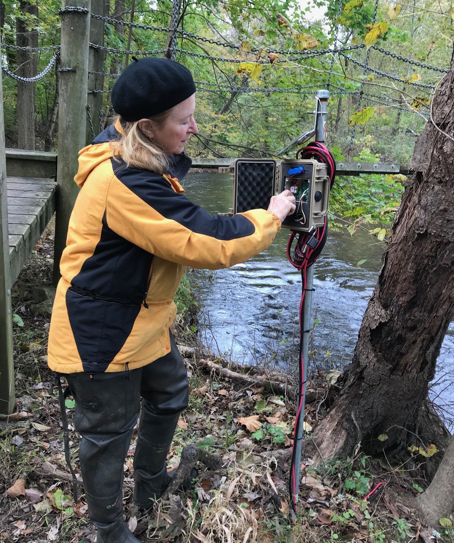
Pictured right: A Penn State Master Watershed Steward attends to routine maintenance of an EnviroDIY Monitoring Station on Pickering Creek, Chester County, PA. Photo credit: Stroud Water Research Center.
For example, the Stroud Center is prototyping a low cost, low power, low weight water level monitoring system for the USGS* based on the Mayfly Data Logger. The device uses commercial radar, cameras, and telemetry (LoRa and LTE) to share river stage data in real-time through AWS IoT Core. The device may help supplement the USGS* Temporary Gauge Network across the United States and other monitoring efforts.
A major emphasis of EnviroDIY is training the community. CUAHSI* has been a great supporter of workshops at the Stroud Center that bring the CUAHSI* and ESIP community together to go through data logger boot camp. EnviroDIY has also been a regular contributor at AGU’s* McGyver DIY sessions over the years to build partnerships across DIY ecosystems.
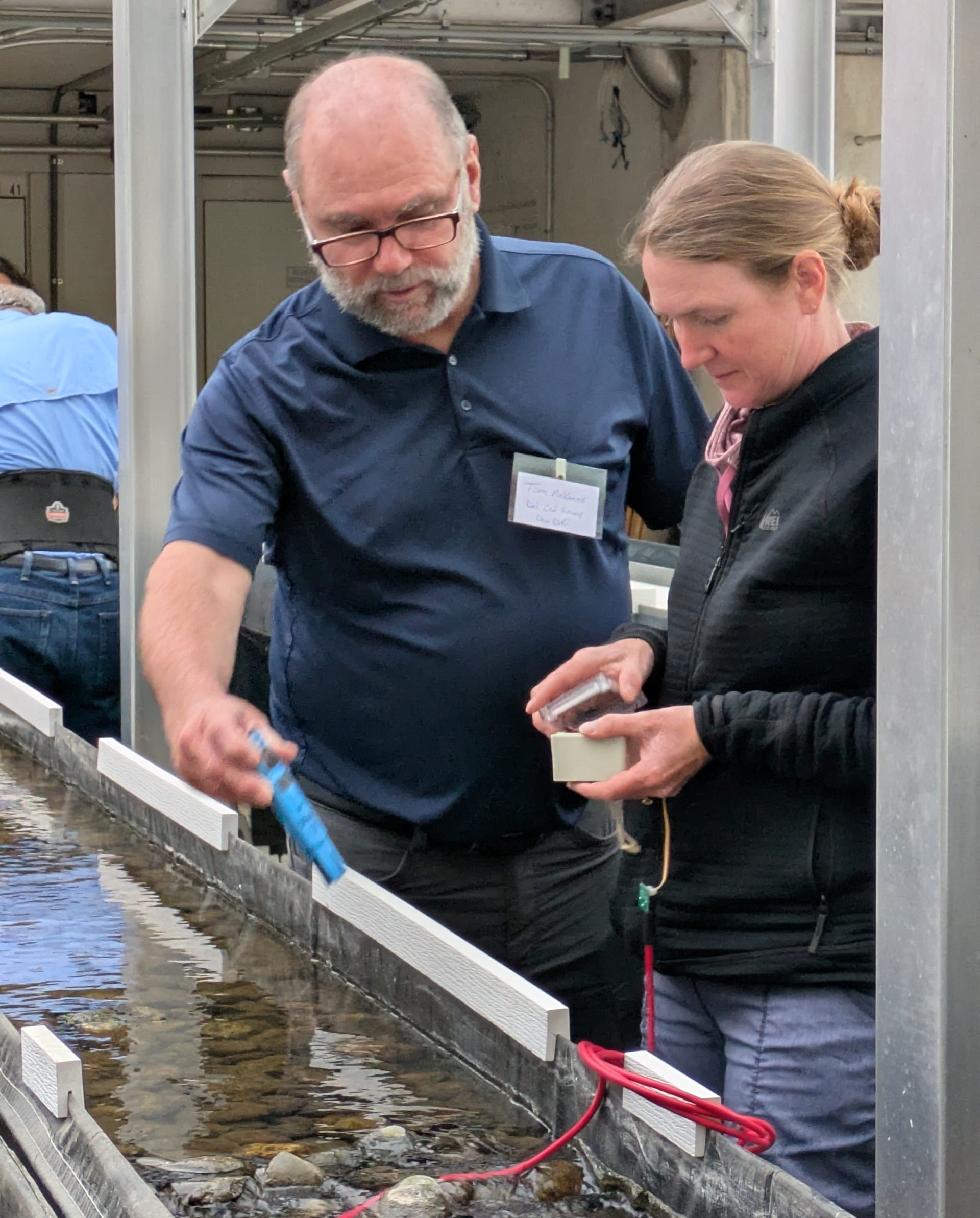
Pictured left: EnviroDIY workshop participants measure temperature of indoor flumes at Stroud Water Research Center. Photo credit: Stroud Water Research Center.
The Stroud Center participates in ESIP’s Envirosensing Cluster and welcomes collaboration around all facets of open source environmental sensing.
Show Me the Data: Portals and Data Visualization
WikiWatershed’s Monitor My Watershed Data Sharing Portal is among the largest data portals in the United States accepting real time data from environmental sensors, with over 2 billion user-contributed measurements. Based on the ODM2 data framework developed by early contributors to CUAHSI* and compliant with OGC* standards, Monitor My Watershed is hosted on AWS* (thanks to an AWS Imagine Grant) and maintained by LimnoTech for the Stroud Center.
Monitor My Watershed accepts data from a user’s internet-connected device through HTTP Post request. Those data are stored under a site and parameter list the user has defined. For example, OPeN-DAP* uses Monitor My Watershed for sharing environmental measurements in real time to the web through a LoRa network. All data shared to Monitor My Watershed is publicly accessible without a login.
Data can be extracted from Monitor My Watershed using an API for interoperability with other dashboards and databases. For example, the Spokane Waterkeeper updates its website with the data they post to Monitor My Watershed, and the Great Lakes Observing System is pulling Monitor My Watershed data into their Seagull data repository.
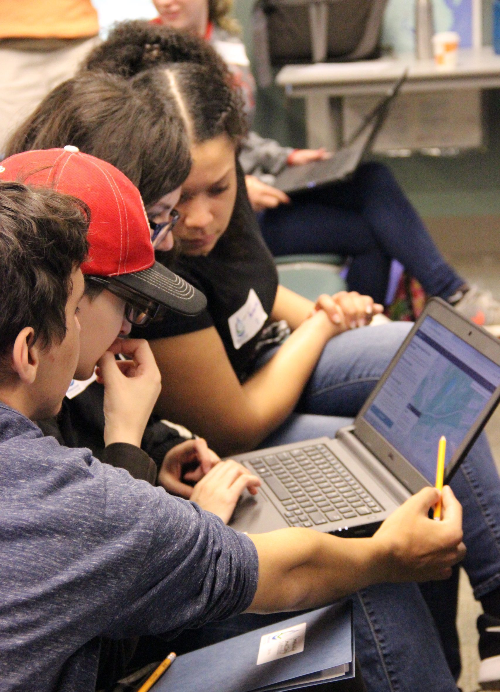
Pictured right: Students interact with Model My Watershed at a workshop at Nescopeck State Park in Drums, PA. Photo credit: Stroud Water Research Center.
A next milestone in Monitor My Watershed’s development is to enable users to link a GeoConnex identifier with their site. This feature will help embed Monitor My Watershed data into the national hydrologic geospatial fabric. The Stroud Center welcomes collaboration with ESIP Partners to advance interoperability of all environmental data.
Solving Water Challenges with Open Source Tools
With over 20,000 registered users (growing 13% per year) and over 1 million page views per year, WikiWatershed is helping people advance the science, restoration, and conservation of their watersheds and waterways. The Stroud Center and our partners are constantly seeking ways to improve the accessibility and interoperability of the data WikiWatershed uses and produces. The goal is for WikiWatershed to lead to repeatable analyses that lead to positive outcomes for people and the planet.
The Stroud Center welcomes collaboration with ESIP Partners in pursuit of this goal. Please contact Scott Ensign (ensign@stroudcenter.org) for more information on WikiWatershed’s tools and opportunities for engagement.
* = ESIP Partner
This blog was written by Scott Ensign, with edits from Zoe Gentes and review by Mark Parsons.
ESIP (Earth Science Information Partners) is a community of partner organizations and volunteers. We work together to meet environmental data challenges and look for opportunities to expand, improve, and innovate across Earth science disciplines. Learn more and sign up for the weekly ESIP Update for #EarthScienceData events, funding, webinars and ESIP announcements.
###