Join us in Austin, TX this summer for the ESIP July Meeting! Early Registration and Call for Session Proposals now open.
Drones Measure Mountain Snow
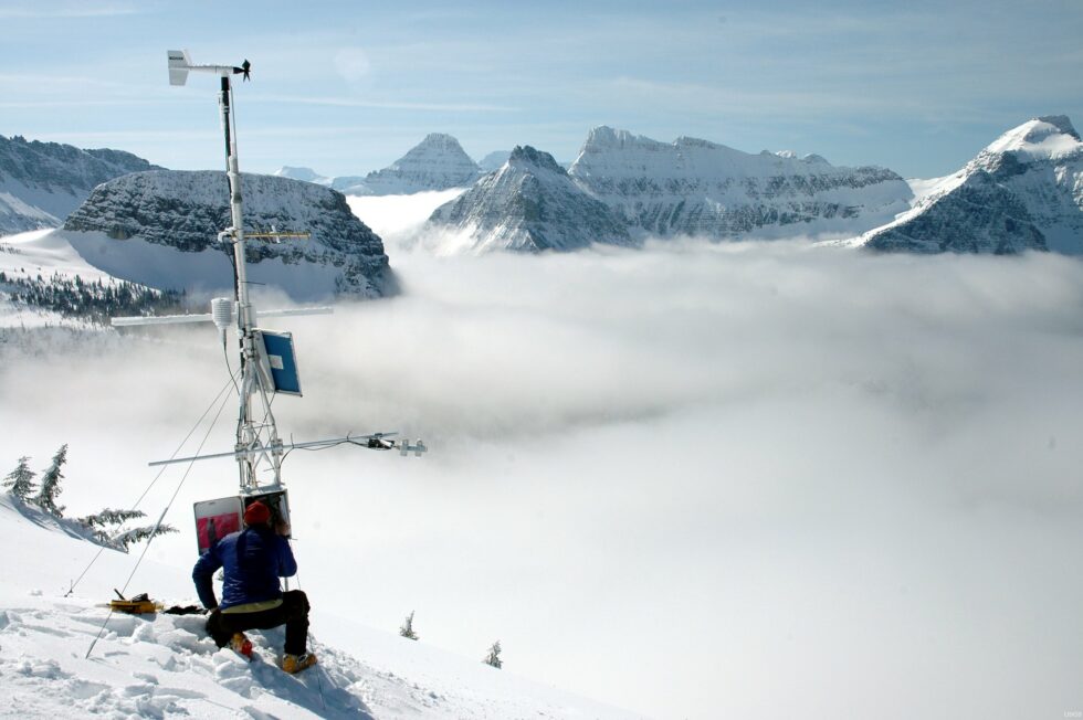
Garden Wall Weather Station, Montana. Credit: Erich Peitzsch, USGS
Mountain topography is what makes their vistas grand and awe-inspiring. Especially when the first snows outline peaks or linger late into the warmer months. But such variable terrain and seasonal changes present a challenge for measuring the reflectivity of snow, called albedo.
Albedo, the ratio of reflected to incoming solar radiation, is an important factor in water and climate balance calculations. In order to measure albedo in complex alpine terrain, researchers have to trek high to gather ground measurements or rely on precarious, high-altitude weather stations. Neither of which can capture a mountainous area’s beautiful but heterogeneous snow cover.
That is why Eric Sproles from Montana State University applied for an ESIP Lab grant. He hoped that by using Uncrewed Aerial Vehicles (UAVs or drones), researchers could survey larger areas. The catch: The bird’s eye view of a UAV generates slightly different measurements. So, the ESIP Lab helped cover ground measurement validation to determine the error correction for UAV albedo measurements. The incubator success helped set the stage for larger projects funded by the USGS National Innovation Center, USGS National Land Imaging Program, and Montana NASA EPSCoR.
In January 2022, Sproles and his team published their findings in Frontiers in Remote Sensing, offering an inspiring view not just from the mountaintop but of its snow-scattered, drone-surveyed topography, too.
ESIP Lab Supports Innovation
The ESIP Lab offers small-grant funding opportunities for Earth science technology research projects. Looking at new ideas, the ESIP Lab focuses on roadblocks that a small investment can help overcome. The Lab also provides a collaborative environment, access to tools and cloud resources, and support to innovate.
Learn more about current or recent RFPs: esipfed.org/rfp
This blog post was written by Allison Mills with edits by Annie Burgess and Eric Sproles.
ESIP stands for Earth Science Information Partners and is a community of partner organizations and volunteers. We work together to meet environmental data challenges and look for opportunities to expand, improve, and innovate across Earth science disciplines.
Learn more esipfed.org/get-involved and sign up for the weekly ESIP Update for #EarthScienceData events, funding, webinars and ESIP announcements.