FUNding Friday: Where creativity meets science
Curiosity and openness are core to the Earth Science Information Partners (ESIP) community. One of the more playful initiatives at ESIP is a lively microfunding competition held during the July in-person meeting called FUNding Friday.
Here are the 2025 projects plus short write ups about each.
What can you do with a bunch of markers, earth data scientists, an idea, and an evening?
Make a project pitch for ESIP microfunding!
The FUNding Friday competition is ESIP’s annual small grant competition, and it’s an important way we nurture fresh ideas and research within our community. While ESIP is broadly dedicated to tackling big challenges through data, it's often the small steps and off-the-wall ideas that can drive action. FUNding Friday embodies the idea that even our serious, data-driven community needs to save space for these small, creative ideas.
What’s at stake? ESIP awards multiple microgrants each year, and awardees are expected to present the results of their project at a future meeting. $5,000 grants are given to ESIP members, and $3,000 grants go to students or K-12 teachers.
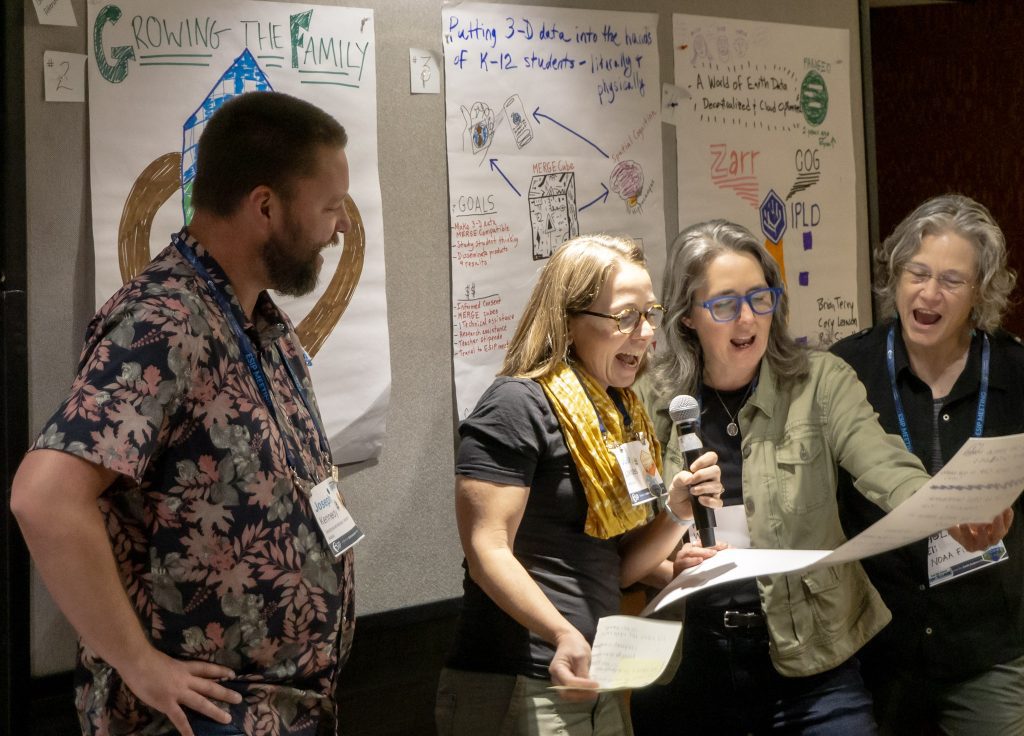
This beloved event takes place at the end of every July ESIP Meeting, and it's a ton of fun! The competition starts on Thursday night with a lively, social gathering, often held at a local bar or eatery, where competitors craft their posters. This is where the creative planning happens: participants get colorful, strategize presentations, and sometimes even plan songs!
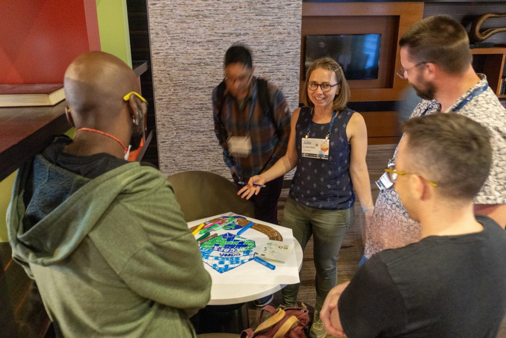
The very next day, Friday morning, is showtime. Competitors present their posters and deliver a two-minute pitch – short, sweet, and engaging! The audience then votes for their favorites across two categories: Teachers & Students and Regular Attendees.
Here are the 2025 winning FUNding Friday projects and their point-of-contact (POC). Each section includes the group’s poster and a short write up crafted using the UpGoer Five text editor (that only uses the 1,000 most common English words).
- “Weather Data and Climate Change” | Bertha Martinez Ramirez
- “Engineering a Cleaner Ocean: Save Our Home!” | Lalita Khemka
- “What’s in The Water?” | Alton Wimberley
- “A World of Data: Decentralized and Cloud-Optimized (aka Cloud-Optimized Decentralized Earth Data – “CODED”)” | Cory Levinson
- “Earthaccess: Growing the family” | Julia Lowndes
- “Putting 3-D data into the hands of K-12 students – literally and physically” | Carla McAuliffe
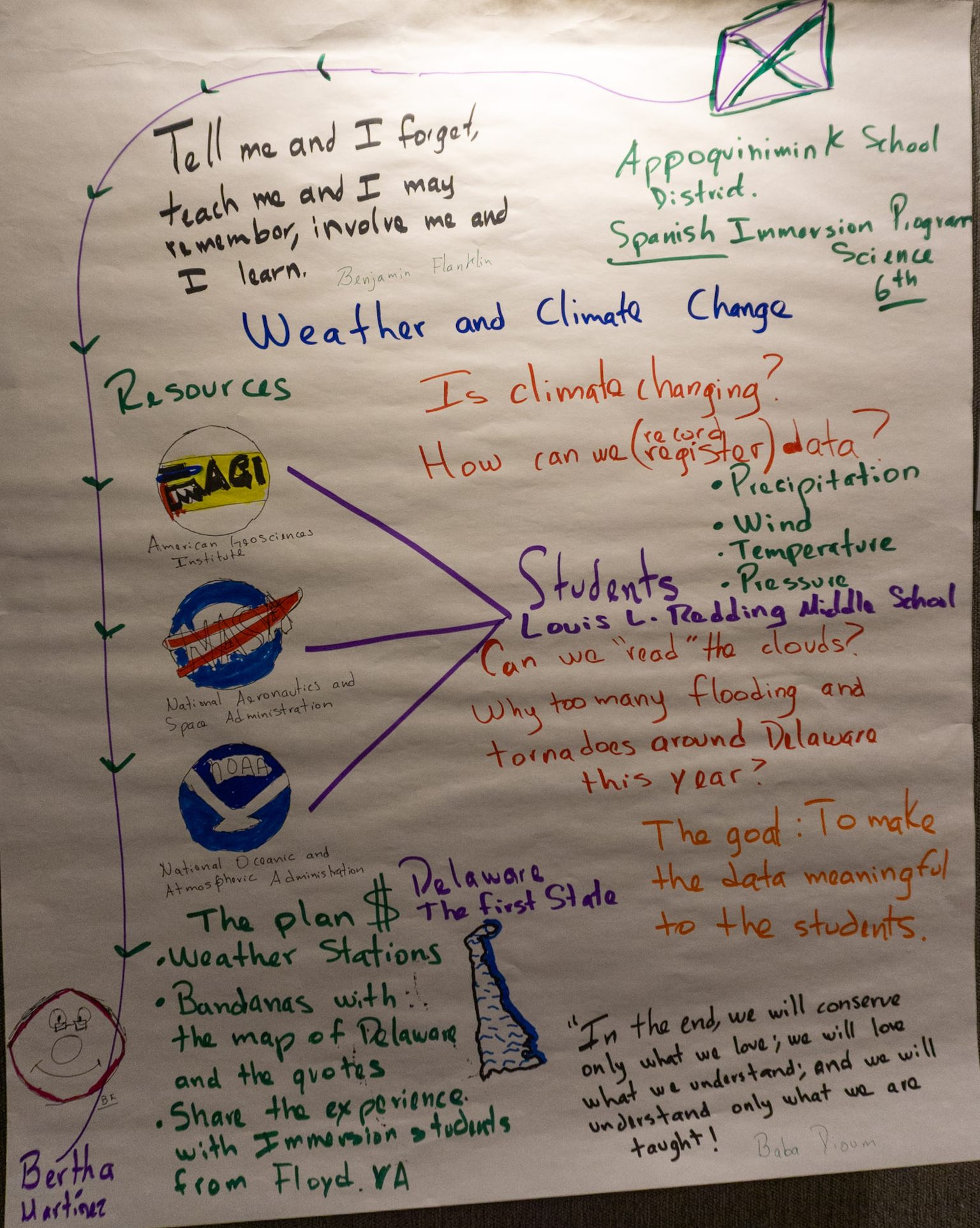
Weather Data and Climate Change
Bertha Martinez Ramirez (Appoquinimink School District)
Observing the weather helps us be more aware of our local environment.
The Plan: collect basic weather data, reflect on the changes recorded, and learn a bit of culture… in a Spanish Immersion program!
Middle school students will learn how to really look at their home area. They will see how things change such as wind, rain, how warm or cold the air is, and other things. Then, they will try to find what happens a lot with the air and rain and such. Kids like to ask questions, and maybe among these students are future big thinkers. What makes this idea special is that it will be carried out by students in their beautiful home state (Delaware), and will also be shared by another school in the next state (Virginia).”
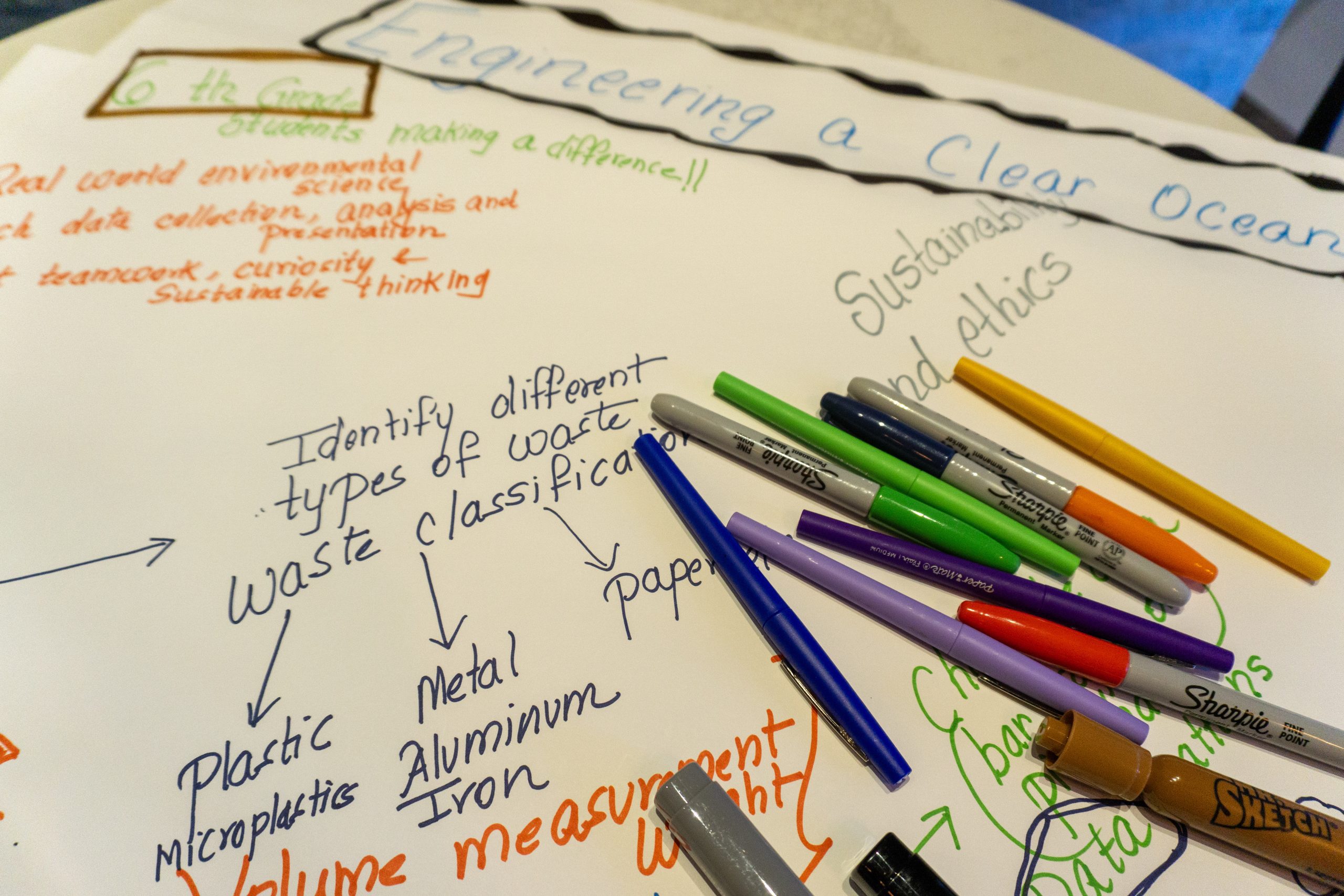
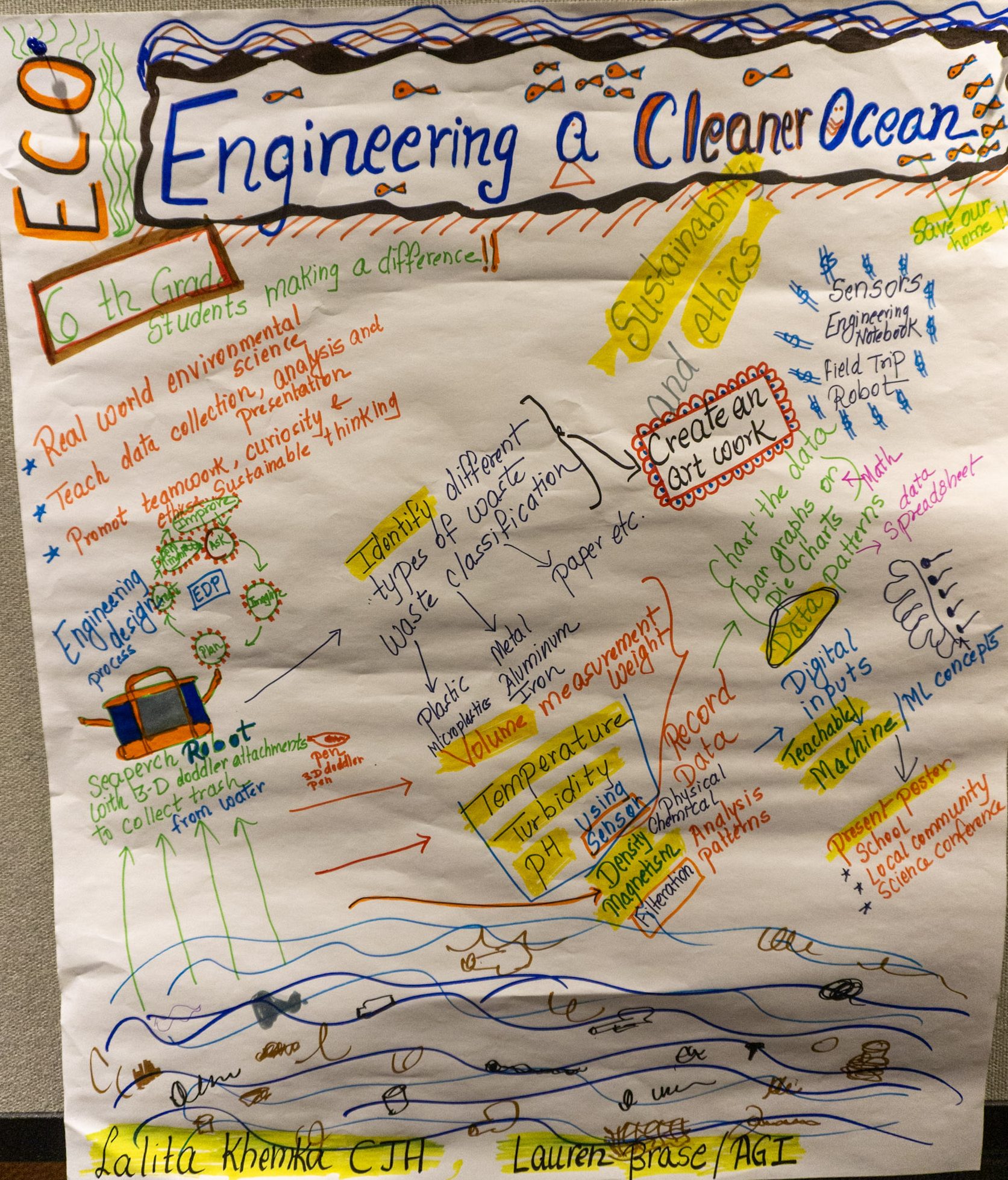
Engineering a Cleaner Ocean: Save Our Home!
Lalita Khemka (Cardiff Junior High School)
The accumulation of ocean debris poses an environmental challenge, but also an opportunity for student learning.
The Plan: design and test robotic systems using SeaPerch kits and 3D Doodler attachments to collect and sort ocean debris.
Students will make parts that go in the big water, and use things to build the parts and other things to help pick up stuff in the water. They will write down important numbers about the stuff they get. These numbers will tell us how much stuff they found, what kind of stuff it is, how warm the water is, how clean the water is, and other ways to talk about the water.
This work helps students learn about building things and learning by using their hands. It also shows them to care for the world and use old things to make new things.
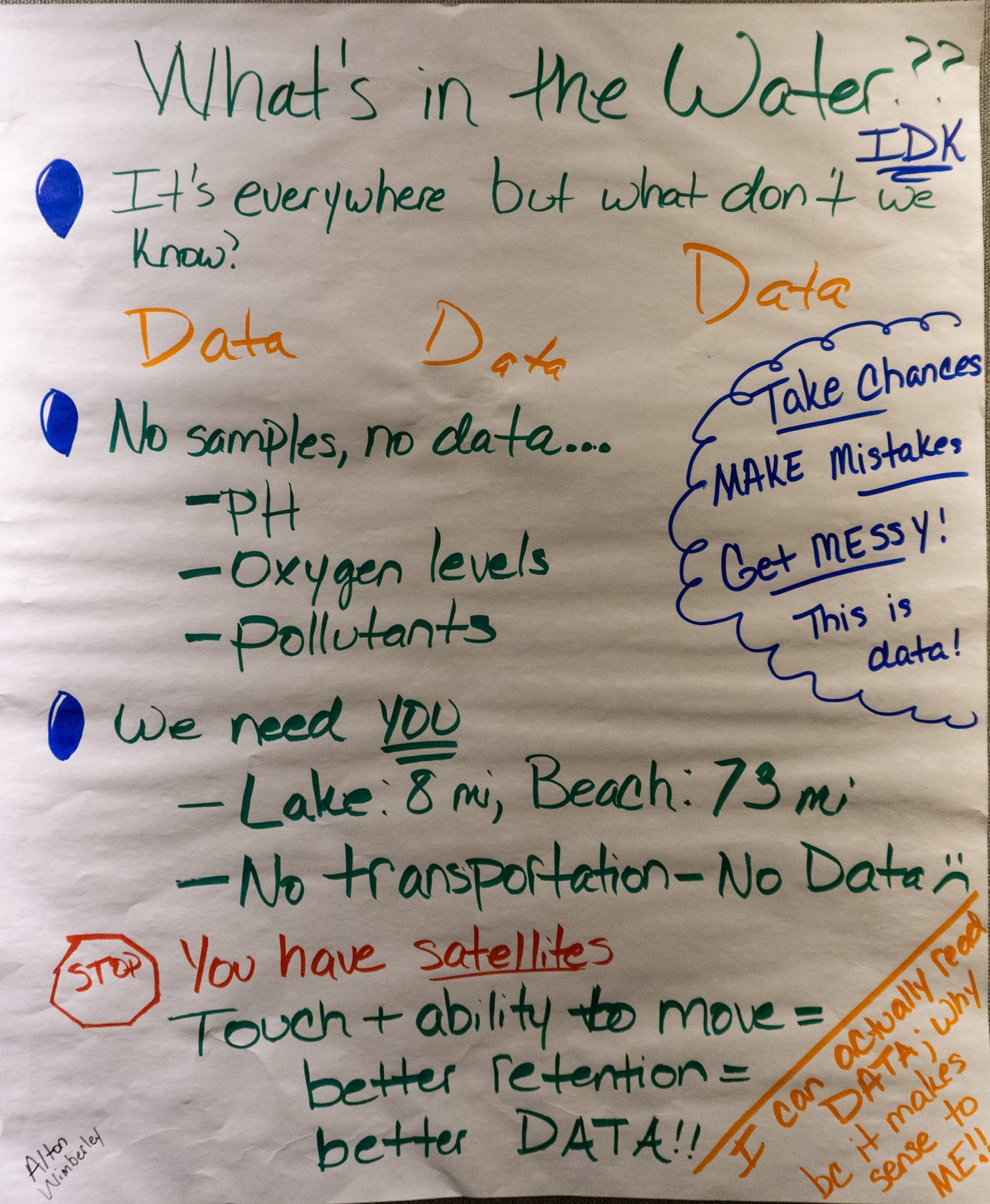
What’s in The Water?
Alton Wimberley (Tompkins High School)
Humans need water to survive… but do we really know what’s in it?
The Plan: students will collect water samples from everyday sources, puddles, the ocean, and more to analyze contents and learn critical skills.
Water is a human need. Students drink water, see when it rains, and see when we pass by a big water or small water. However, do we really know what is in the water? This is where the students get to work. Students will take bits of water from bottles, school water, water near land, and other places to see what is in the water. This will give students the chance to think big and think about how humans and animals can change because of the water they use.
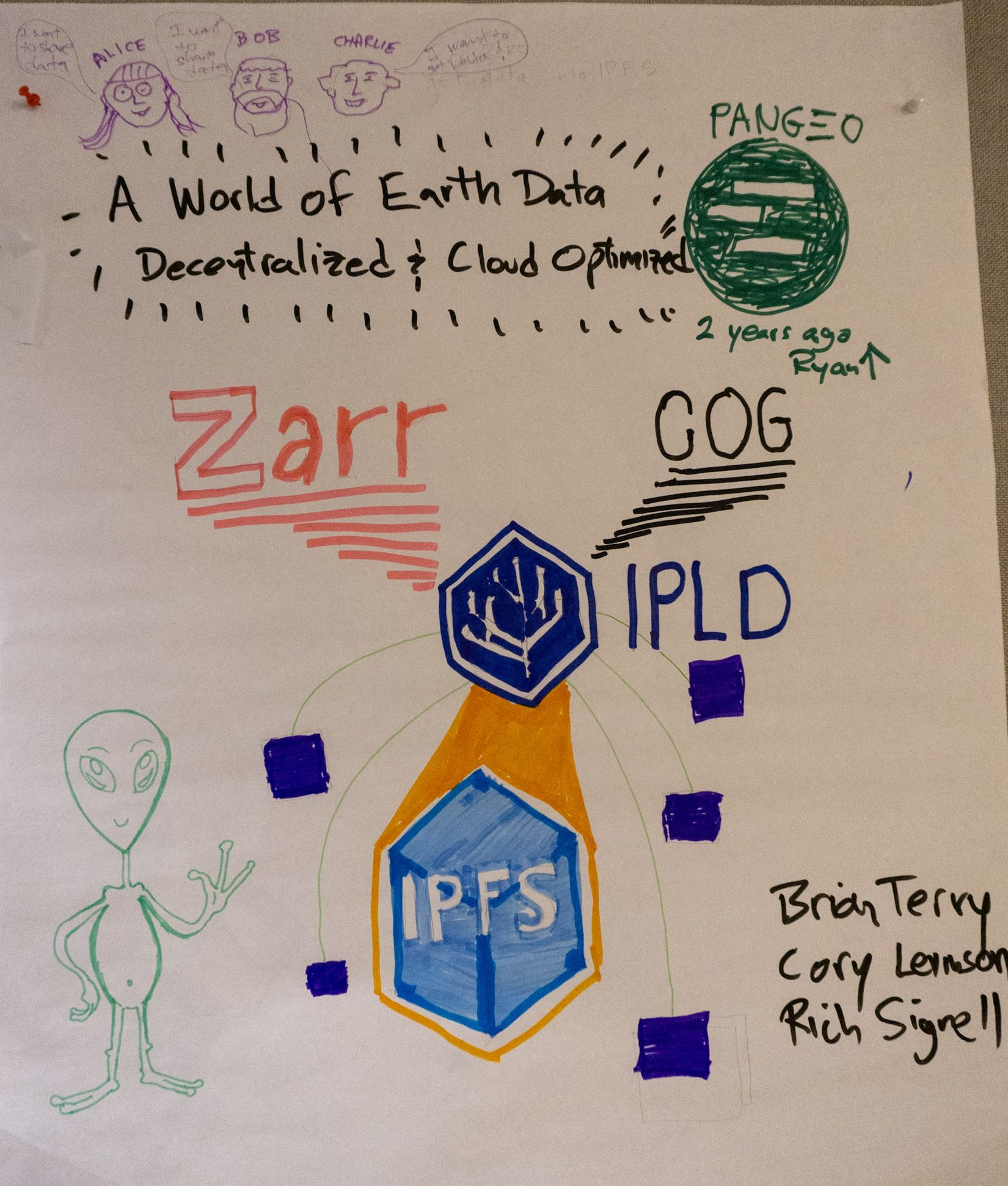
A World of Data: Decentralized and Cloud-Optimized (aka Cloud-Optimized Decentralized Earth Data – “CODED”)
Cory Levinson (UC Davis), Brian Terry (AMA Inc), Rich Signell (Open Science Computing LLC)
Recent efforts to explore storing and serving cloud-optimized geospatial formats have not yet produced a clear understanding of performance or best practices.
The Plan: benchmark InterPlanetary File System (IPFS) performance for varying geospatial datasets, explore decentralized storage, what tools and formats work best, and other key considerations.
Today, there are ways to save and find pictures on a computer where people put the same picture on many different computers (not just one). To get a picture back, you use the name of the picture, not the name of the place where you kept it. This is better because if the first computer stops working, you can still find the picture by getting it from other computers who saved it.
We will look at how fast these computers are when dealing with really really big pictures – like pictures of the world taken from outer space. We will see when it is best to use this kind of approach, what ideas and types of pictures work well, and what you should think about when using this approach. If things are too slow, we will try to make some changes to make this way of saving and finding pictures on computers easier to use in the real world.
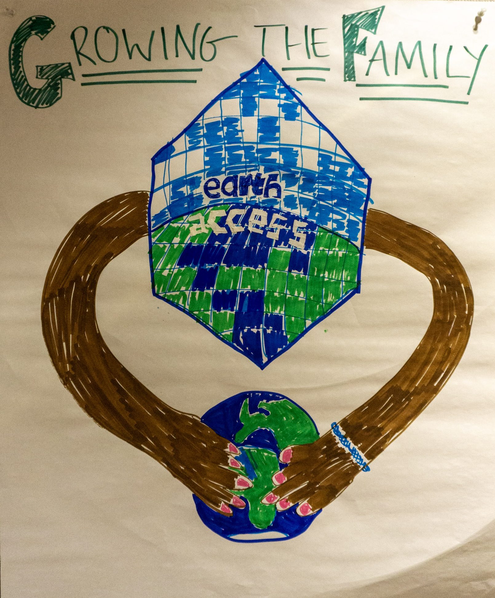
Earthaccess: Growing the family
Julia Lowndes (Openscapes), Joseph H. Kennedy (NASA Alaska Satellite Facility), Eli Holmes (NOAA Fisheries), Kate Wing (Intertidal Agency), Amy Steiker and Luis Lopez (NASA National Snow and Ice Data Center), Danny Kaufman (ASDC), Chris Battisto (NASA GES DISC)
Earthaccess helps overcome barriers to code-based NASA data access for many users working in the cloud.
The Plan: hold a virtual and in-person Hackday at AGU2025 to explore including data from agencies like NOAA, USGS, and Copernicus and create a roadmap for earthaccess expansion.
Come join us for a day, both in person and not in person – for free!
We work with pictures and stuff about our world. We use a few lines of words to make getting these pictures as easy as possible. We want to grow and work with more numbers and pictures of different types from different places.
Join us to share your ideas and to help us do this. We will work together to grow and turn ideas into something you can use. You can come and go when you want!
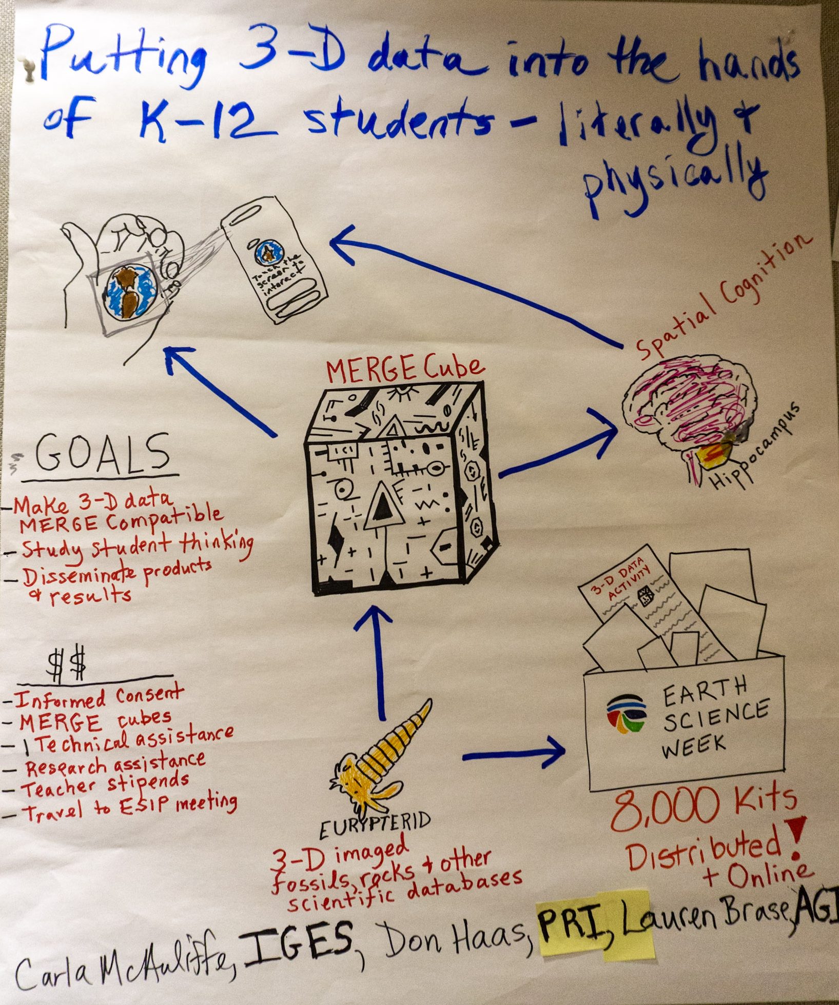
Putting 3-D data into the hands of K-12 students – literally and physically
Carla McAuliffe (Institute for Global Environmental Strategies), Don Hass (Paleontological Research Institution), Lauren Brase (American Geosciences Institute)
3-D data leads to scientific discoveries and improves spatial cognition and reasoning.
The Plan: use MERGE Cubes to allow students to hold a 3-D dataset in their hands (like fossils, a meteorite, an Earth-moon model) and study their spatial reasoning responses.
Students can learn more about how the world works when they can touch and move the things they are learning about. Also, when students work like this, it helps their brains get better at seeing things and places—and this also helps them think better with words. We are using a small, soft, block-like thing that lets students hold pictures in their hands (such as old things from the ground or rocks from the sky). They can turn the thing around, look at it from every side, and learn from it.