Welcome to the new ESIP website!
Agriculture, Climate and Water: Can Drones Help Us Make Better Management Decisions?

Flinging a small fixed-wing drone into the crisp morning air to monitor an agricultural field, the whine of the propellers gives way to a burst of radio chatter. I direct my small undergraduate team to measure greenhouse gas emissions in the field while keeping an eye on the operations laptop, watching the flight progress. This careful combination of in-situ field emissions measurements and high-resolution remotely sensed imagery has exciting implications for the improvement of agricultural greenhouse gas emissions monitoring.
An email alert from NASA’s Jet Propulsion Lab: Jane is confirming lightweight greenhouse gas sensors and hardware purchases for building and modifying our first drone platform. It’s an exhilarating feeling, assembling and collaborating with this amazing team, beginning from a lucky accidental drone conversation under the stairs at the 2015 Federation of Earth Science Information Partners (ESIP) Winter Meeting, and building to this exciting interdisciplinary research based on agricultural emissions monitoring, remote sensing, engineering, and a sincere desire to tackle the problems of our changing climate, save the world.
We still have a long way to go.
Measuring Agricultural Field Emissions:
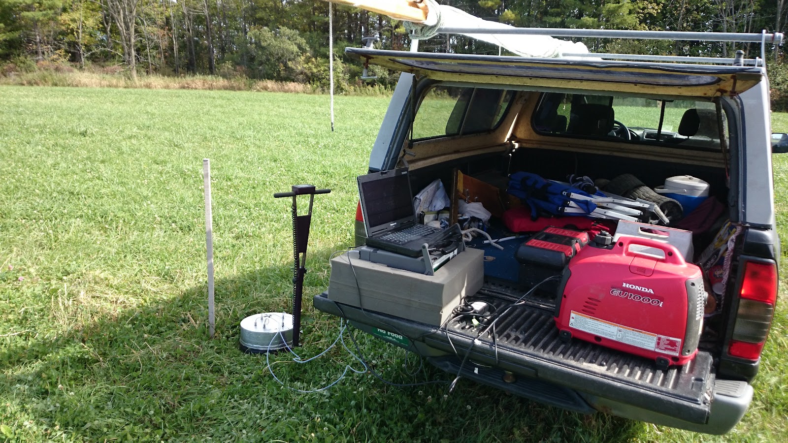
So this was my office for most of the summer.
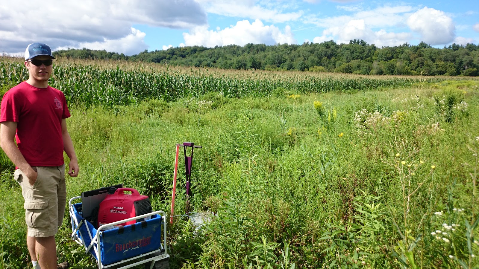

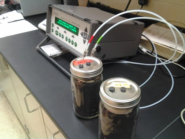
As a member of the Adair Lab, I spent many hours with a small team of interns traipsing through hay fields and corn fields, pushing wayward non-four-wheel-drive trucks out of muddy ditches, and measuring carbon dioxide and nitrous oxide emission rates from static, enclosed sampling chambers. We used a Photoacoustic Gas Monitor (INNOVA 1412) for weekly in-field sampling: before storm events, after storm events, accidentally during storm events, and all through a very wet spring and summer into a very hot and dry late summer and early autumn. These data will hopefully reveal important information about emissions flux rates, especially in comparing the differences between conventionally managed agricultural fields with fields managed with intent for the mitigation of climate and environmental damage.
Unfortunately, the story is turning out to be far from simple.
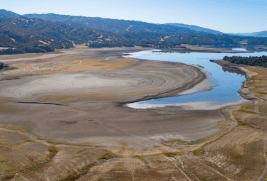
Agriculture and Nutrients: Water Quality and Climate Tradeoffs?
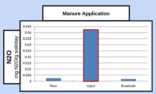
Supporting our expanding human population with food, fiber, and fuel has intensified demands on agricultural land. Increased crop production and fertilizer use has resulted in an outflow of these nutrients, through volatilization, leaching, and water runoff, which can create eutrophic conditions in lakes, ponds and rivers. To retain nutrients in the soil and improve water quality, farmers in Vermont are using new manure and field management strategies, including injection of fertilizer into the soil. While such strategies are promising for improving water quality, our understanding of their effects on greenhouse gas emissions is both crucial and limited.
Though injection of fertilizer has demonstrated improvement in overall nutrient retention, we are finding (through both in-field sampling and soil incubation studies in the lab) that injection increases soil emission rates, especially nitrous oxide, and more so when combined with a warming environment.
Emissions Monitoring: Necessary and Challenging
With climate change upon us, developing a full understanding of the benefits and tradeoffs of agricultural field management strategies in addition to scaling up our in-field emissions estimations to address larger agricultural landscapes are the next crucial steps in agricultural mitigation research.
Manure application methods and field management activities are not solely responsible for soil emissions and mitigation, environmental conditions coupled with soil characteristics and field topography can alter emissions rates and nutrient retention, and can vary significantly over larger agricultural landscapes or even over a single field. Monitoring this complexity, especially for regional areas, such as entire watersheds, is challenging as current measuring techniques are highly localized and point specific. Current state-of-the-art GHG monitoring is based on very labor-intensive and/or expensive methods. Though these methods (such as our in-situ closed chambers, flux towers or airplane sampling) can produce robust results, they have a limited range or are limiting by their high costs, and are not effectively or accurately scaled up for regional monitoring. More efficient and cost effective monitoring methods are needed to acquire these critical comprehensive regional agricultural GHG emissions data.
Remote sensing provides an opportunity for improved range and efficiency of regional agricultural activity and emissions monitoring, but many of the in-field processes that dramatically alter emissions cannot be adequately detected using existing remote sensing methods. Higher-resolution and more frequent monitoring is needed.
This brings us back to that autumn morning with the eBee senseFly.
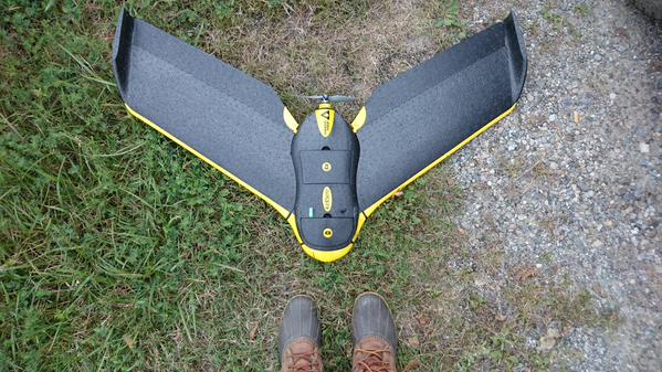
Drone-Based Remote Sensing:
The eBee senseFly is a professional mapping drone that the University of Vermont’s Spatial Analysis Lab (SAL) uses for a wide variety of environmental and structural monitoring, as well as disaster response and support. Today, the SAL's UAS Team has tuned the multispectral and near infrared cameras to capture slight variations in vegetation and saturation on our two agricultural hay research fields.
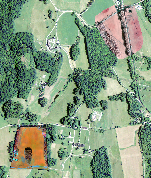
bottom left: multiSPEC camera flight
top right: near infrared camera flight
In addition to high resolution imagery, the eBee’s Real Time Kinetic (RTK) capabilities allow for microtopographic mapping of the fields. These elevation models will provide inputs for improved inundation, nutrient and emissions estimations and modeling validation. The planned addition of lightweight greenhouse gas sensors will (hopefully) further increase our emissions measuring capabilities.
Pairing this drone imagery, which can be obtained frequently to monitor field management activity and environmental events, with in-field emissions measurements will hopefully allow us to develop the techniques and methodology to more accurately, efficiently and cost effectively scale up our landscape-wide agricultural emissions estimations. Estimations that will help us make more informed critical agricultural land management decisions
Improve strategies for mitigating environmental and climatic destruction, save the world.